 BAM GeoPortal
Breeding Birds Survey 1966-2019: BAM Harmonized
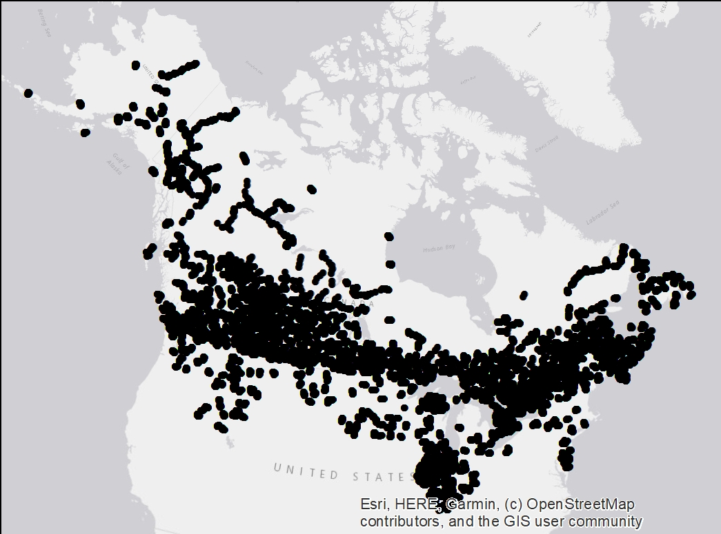
BBS is a cooperative effort between the U.S. Geological Survey's Patuxent Wildlife Research Center and Environment Canada's Canadian Wildlife Service to monitor the status and trends of North American bird populations. Geospatial data are assembled at the route level and are accessible throught the USGS website. Over the years, BAM staffs with the help of CWS succeeded to assemble a set of coordinates at the Stop level for some of the Canadian and North of the USA routes. A total of 70677 stops locations, mostly across Canada, are mapped in ESRI shapefile format. Those coordinates were then used to convert BBS data into the latest BAM database format (v6). Reach Point of Contact mentionned below to access BBS_BAM harmonized data.
BBS is a cooperative effort between the U.S. Geological Survey's Patuxent Wildlife Research Center and Environment Canada's Canadian Wildlife Service to monitor the status and trends of North American bird populations. Geospatial data are assembled at the route level and are accessible throught the USGS website. Over the years, BAM staffs with the help of CWS succeeded to assemble a set of coordinates at the Stop level for some of the Canadian and North of the USA routes. A total of 70677 stops locations, mostly across Canada, are mapped in ESRI shapefile format. Those coordinates were then used to convert BBS data into the latest BAM database format (v6). Reach Point of Contact mentionned below to access BBS_BAM harmonized data.
Le Relevé des Oiseaux Nicheurs est un effort de coopération entre le Patuxent Wildlife Research Center du U.S. Geological Survey et le Service canadien de la faune (Environnement Canada) pour surveiller l'état et les tendances des populations d'oiseaux d'Amérique du Nord. Les données géospatiales sont assemblées à l'échelle du parcours et sont accessibles via le site Web de l'USGS. Au fil des ans, le personnel de BAM, avec l'aide de Service canadien de la faune, a réussi à assembler un ensemble de coordonnées associés à l'arrêt pour certains parcours canadiennes et du nord des États-Unis. Au total, 70677 arrêts, principalement à travers le Canada, sont maintenant cartographiés. Ces coordonnées permis de convertir les données BBS en utilisant la structure de la base de données BAM (v6). Pour acquérir les données BBS harmonisé en format BAM, contactez le point de contact mentionné ci-dessous.
Simple
- Date (Publication)
- 2020-12-20
- Other citation details
- Lors que vous utilisez les données à des fins de cartographie, d’analyse, de recherche, d’évaluation ou d’affichage, veuillez citer la source de la façon suivante : Service canadien des forêts. 2017. Base nationale de données sur les feux de forêt du Canada – Données sur les feux des Agences. Ressources naturelles Canada, Service canadien des forêts, Centre de foresterie du Nord, Edmonton, Alberta. http://cwfis.cfs.nrcan.gc.ca/ah/nfdb
- Status
- Under development
- Maintenance and update frequency
- Annually
- Theme
-
-
Continents, countries, Canadian provinces.
Continents, countries, Canadian provinces.
-
-
Canada
Canada
Canada
-
-
-
Distribution and Range
Distribution and Range
Distribution et Aire de Répartition
-
- Access constraints
- Other restrictions
- Use constraints
- otherRestictions
- Spatial representation type
- Vector
- Metadata language
- English
- Character set
- UTF8
- Topic category
-
- Environment
))
- Reference system identifier
- WGS 1984
- Distribution format
-
-
ESRI Shapefile
(
)
-
ESRI Shapefile
(
)
- OnLine resource
-
Website access
(
WWW:LINK-1.0-http--link
)
North American Breeding Bird Survey (BBS) website
North American Breeding Bird Survey (BBS) website
Relevé des oiseaux nicheurs (BBS) de l'Amérique du Nord (site web)
- OnLine resource
-
local_geoserver:bbs_dec2020
(
OGC:WMS
)
Visualize BBS
Visualize BBS
Visualizer les données BBS retenues
- Hierarchy level
- Dataset
Overviews
Spatial extent
Provided by
